Yuri, YL2GM will be active as VK9LA from Lord Howe Island, IOTA OC - 004, 14 - 24 June 2024.
He will operate on 160 - 10m.
Recent DX Spots VK9LA
VK9LA Log search QSL via YL2GN, ClubLog OQRS, LOTW.
VK9LA Previous activities:
Doug, VK3YQS is currently active as VK9LA from Lord Howe Island, IOTA OC - 004.
He is working on HF Bands.
QSL via home call.
Ads for direct QSL:
Doug Speedy, 6 Clements Street, Highett, 3190, Australia.
Previous activity:
K5YY, SQ8X, SQ9DIE, SV2KBS, VK3HJ, VK3QB, VK4IO, VK4VCH, VK5CP, VK5PO, VU3RSB, VK4FW will be active from Lord Howe Island from 24 March till 3 of April 2009 as VK9LA.
They are will operate on 160 - 6m band CW, SSB, RTTY.
QSL via VK4FW.
Lord Howe
This small-sized bird's-eye view of Lord Howe resembles a neat bagel, a horseshoe, half a bagel, or, much more authentic to that part of the world, a native's boomerang. No surprise: Australia's Lord Howe is an isolated part of the state of New South Wales.
Located unusually beautiful piece of land, stretching from north to south for 10 kilometers, and the width does not exceed 2 kilometers, in the southernmost sea of the Pacific basin - the Tasman Sea. To be even more precise, Lord Howe is somewhere in the middle between the Australian island of Norfolk and the northeastern coast of Australia, separated from the island by 770 kilometers of sea water.
A very precise geolocation is given by two geographical coordinates on a map of the Southern and Eastern Hemispheres:
- 159°15′02″ E (eastern longitude);
- 31°45′21″ S (south latitude).
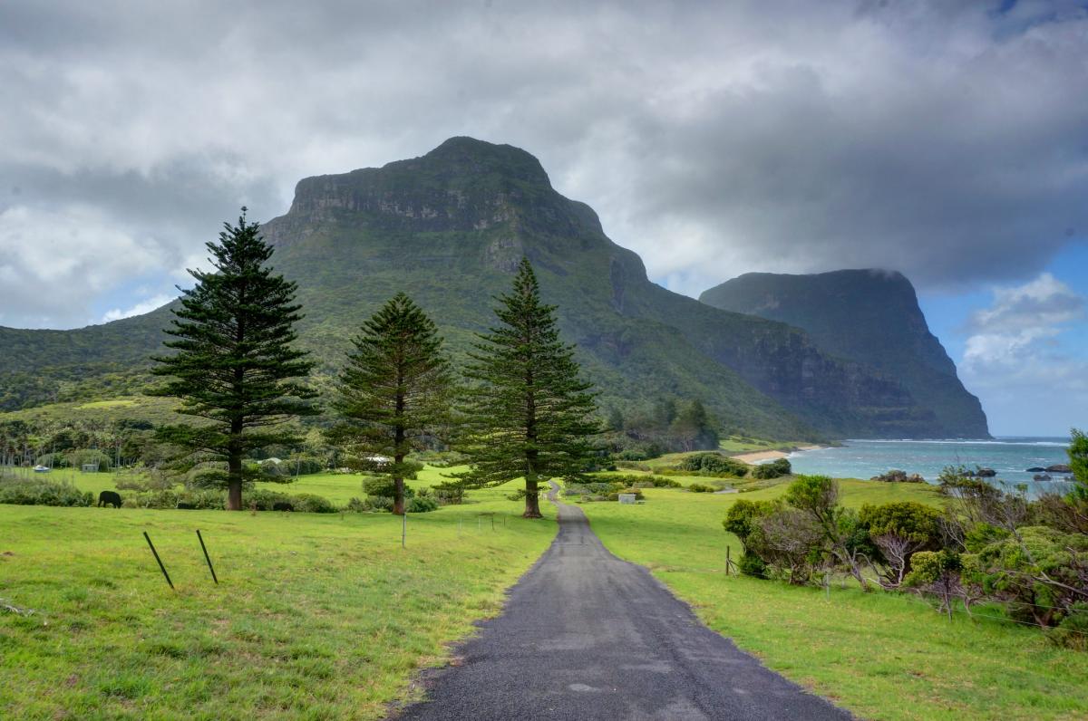
 Road to the Mountains, Lord Howe Island. Author - Michael Howard.
"Let's get to know each other, Lord!"
Firstly, it is a UNESCO World Heritage Site, protecting the preserved primitive nature of the island. To this end, some of the animals introduced there have even been deported.
Secondly, the area of the "boomerang" is really modest: 14.55 square kilometers. This is about 100 times smaller than the area of St. Petersburg.
Third, mankind learned about the existence of Lord Howe relatively recently, in 1788. Then, on a sunny day on February 17, an English ship accidentally sailed past the island - a messenger sailing ship with the unromantic name "Supply Man". It was ferrying prisoners from a prison in Australia to the casemates on Norfolk Island.
Captain Lidgberd did not ignore the picturesque island, which became his geographical discovery.
Fourthly, the two shores of Lord Howe are not alike one to the other. The northern shore is lower (not more than 300 meters above sea level), and abounds in lowlands and low hills. The southern part is much higher, at 875 meters, protruding from the water, and has a couple of mountainous, oddly shaped massifs of basaltic composition:
- Hoover;
- Lidgberd.
Fifthly, part of the waters around the western shore of the island has a powerful coral reef. This has formed the tiny Rabbit Island, which is nestled between the reef and Lord Howe. The large colonies of coral polyps that have settled offshore of the island are believed to be the southernmost point on Earth of coral origin.
Sixth, Lord Howe is surrounded by no less than three dozen tiny satellite islets.
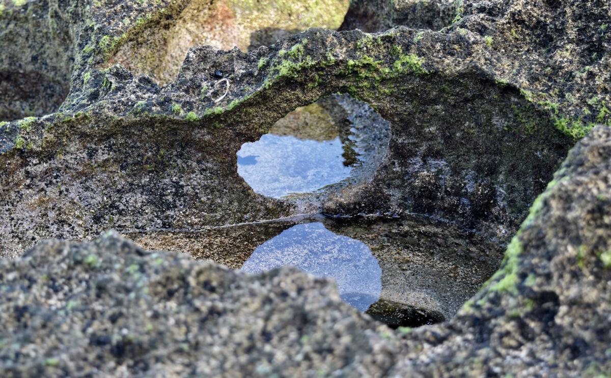
 Rocks and reflection, Lord Howe Island. Author - Treen42.
"Rising from the abyss of the sea" - the origin of the island
It's volcanic. That is, what is now Lord Howe Island is the result of the "fire-breathing" processes of magma, lava and ash that took place in this part of the Tasman Sea over 20 million years ago. Gradually, the volcanoes lost strength and subsided, forming a stable firmament in the waters that became the north and south shores of the island.
Between the two shores, in the center, layered and sand from coral - that's the whole brief "story" of many years of formation by nature of the island, which is the oldest island in the Pacific Ocean, "born" from a volcano.
Historically, it is known that two volcanoes took part in the birth of Lord Howe, 20 million years ago, forming a different texture of the northern and southern islands. Over time, the islands merged into one, in the middle of which remained a high, up to 45 meters, coral cofferdam, covered with dunes.
At a distance of 20 kilometers from the southeastern shore of Lord Howe is located the world's highest volcanic cliff: island Balls Pyramid ("pyramid-ball"). Its highest point extends 650 meters into the sky. At the same time on the entire land surface, measured by 0.8 kilometers, do not meet a single person: the island is uninhabited.
By the way, Balls Pyramid also administratively belongs to the Australian state of New South Wales, and this small island was discovered at the same time as Lord Howe. Simply because both are located next to each other.
"Steam doesn't break your bones" - Lord Howe's climate
The island's localization is neatly at the meeting point of the two hottest climatic belts:
- subtropical;
- tropical.
This climatic "crossroads", reinforced by the unequal height of the northern and southern shores, has caused a sharply pronounced dissimilarity of plants covering different geometry and height of the slopes.
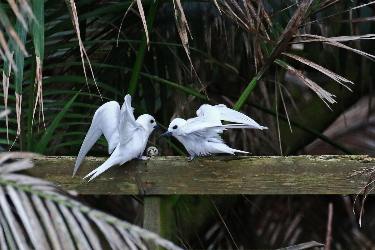
 White Terns, Lord Howe Island. Author - Eleanor Dilley.
"My family and other animals" - what grows and lives on the island
Lord Howe provides plants with the most suitable growing and growing conditions in the Southern Hemisphere:
- ideal temperature;
- optimum humidity;
- sufficient natural insolation.
Trees feel especially well here. For example, an endemic plant that grows exclusively on Lord Howe: Howea forsteriana. It is a unique palm whose seeds are exported from the island to many, not only tropical and subtropical, nations.
The reason for the intensive trade in seeds of this tree is simple: it does well in room conditions, regularly blooming and bearing fragrant fruits in:
- greenhouses;
- conservatories;
- greenhouses;
- simply in the room.
Slender, with beautiful large pinnate leaves, drought-resistant Hovea Forstera is a real decoration of the island, giving it the flair of a fairy-tale oasis in the middle of the sea. The exotic trunk of this palm is particularly eye-catching: it visibly expands at the border with the soil, and all along the trunk there are "scars" of leaves ringing it.
Apart from numerous Howea forsteriana, at least two hundred species of so-called higher plants grow, flower and bear fruit wonderfully on a sufficiently fertile soil containing a lot of nutrients and microelements (a legacy of the magmatic past!). At least one third of them (about 70 species) are representatives of the flora genetically peculiar only to this island, covered with dense tropical forest with one and two tiers.
Of the animals on the island is very much feathered. It is noteworthy that by the 21st century not all of their endemic species have survived, and the reason for this was whaling: rats that had never lived there before were brought to the island from the holds of whaling ships. These mammals have completely wiped out several populations by eating eggs and chicks.
A few words on government
Lord Howe has internal self-government organized by the Island Council. This means that, as part of Australia, the island is free to determine its own internal life.
"It's a pleasure!" - what kind of people live on the island
The residents of Lord Howe are few, if not negligible: only 350 people. The islanders are descended from the first settlers who arrived from New Zealand in 1834. The first settlers literally went into business right away, organizing a whaling base.
It should come as no surprise that the island was completely uninhabited until that year: the great distance from the "big land" was a serious obstacle to the historical settlement of this rather favorable piece of land.
"It's like honey!"
Attracting tourists from the very beginning of the 20th century, the beauty of Lord Howe, due to its small size, is regularly available for a maximum of 4 hundred guests at a time. The limit is set by law.
The islanders themselves, apart from organizing a rather comfortable tourist service, are mostly engaged in preparing seeds of Hovey Forster for sale in other countries. This occupation has successfully replaced the predatory whaling that fell into disrepair in the 19th century.

