Antonio, IK7WUL will be active again as TY2AA from Benin, 14 - 23 February 2025.
He will operate on 10m, SSB only.
Recent DX Spots TY2AA
TY2AA Log search QSL via IZ8CCW, LOTW.
TY2AA call sign used before.
Previous activity:
Francis, F6BUF will be active from Benin as TY2AA.
He will operate on HF bands.
QSL via home call.
Benin
In West Africa, there is a small state called Benin. Its name means "land of quarrels" in the South African Yoruba language. It stands out among other countries on the continent for its turbulent past. On the southern side of its territory is washed by the waters of the Gulf of Guinea, overlooking the Atlantic Ocean. This geographical position contributed to the export of slaves from the African continent from here in times gone by. Infamous names such as Slave Coast and Point of No Return indicate that an active slave trade flourished here.

A little history
The first colonizers were the Portuguese. They were followed by the French, Dutch and English. They built forts and factories, actively engaged in the slave trade. Thus a state called Dahomey was formed. Its rulers were also actively engaged in slave trade, which contributed to the development of the kingdom. After slavery was banned, it became a colony of France. In 1960, the Republic of Dahomey became independent. In 1975, it was renamed the People's Republic of Benin. And since 1990, it has been called simply the Republic of Benin. After several coups, order and stability were established in the state. Now the government of Benin is making efforts to develop tourism.
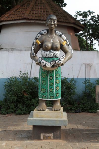
Another very attractive attraction of Benin is the worship of voodoo culture. It is accompanied by various rites and rituals. Sanctuaries of deities can be found everywhere. An interesting fact is that Benin has a public holiday dedicated to voodoo. It is celebrated on January 10. The stronghold of this religion is considered to be the city of Ouida, where in the park called the Sacred Grove, there are many interesting sculptures dedicated to the cult of voodoo. Originating here, the religion quickly spread around the world through exported slaves.
National composition and religions
Benin is home to about 12 million people with a predominant population in the southern regions. The population is ethnically diverse. It is made up of approximately 60 peoples. The overwhelming majority of the population is African. Accordingly, they speak local dialects, although French is the official language. Europeans account for about five percent of the total population. Christianity and Islam are practiced in the country. The majority of the population are adherents of traditional African religions. Catholics are also worshippers of voodoo.

Geographical and climatic features
Benin is divided into two regions: southern and northern. The whole territory includes five geographical belts. In the southern part there is a gulf with a coastal strip. The coastline is a sandy lowland, which in some places reaches a width of 5 km. Behind it there are marshes and lagoons, two of them - Nokue and Acheme - reach the bay. Then begin plateaus covered with sparse forests and savannahs. On them there are small elevations and depressions. In the lower part, the navigable rivers Vene and Mono flow into the Gulf of Guinea. The northwest is characterized by hilly terrain with the low Atacora Mountains. The northeast is characterized by fertile plains. Benin has a fairly dense river network, consisting mainly of tributaries of the large Niger River.
The southern part of the state is located in the equatorial zone, the northern part - in the subequatorial zone. Average values of summer temperatures are +32 °С, winter temperatures - +25 °С. Precipitation will be distributed unevenly, depending on the region. On the average their annual amount varies from 750 to 1300 mm. The southern part of the territory is characterized by two rainy seasons. One lasts from March to July, the other from late September to early November. In the north, the rains are from June to November. Outside this period, droughts are observed. The most favorable climatic conditions are observed from December to March.
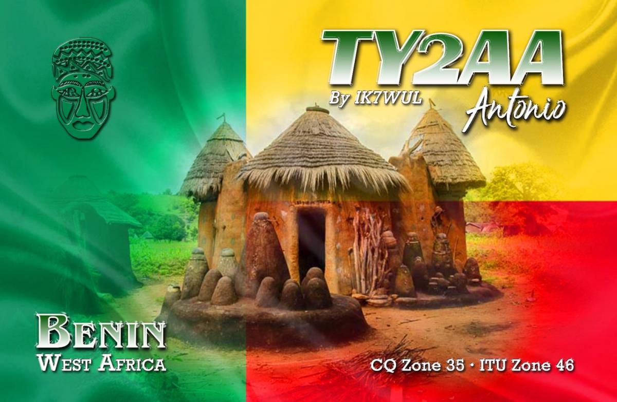
 TY2AA. Benin. QSL Card
Vegetation and animal life
The coastline has tropical forests with evergreen plants. There are also palm and teak groves. In the savannah there are acacias, palm trees, and karite trees. Farmers grow various vegetables, corn, yams, rice, maize, maize, millet, cashew nuts and peanuts. The plant life of the country is rich in various exotic fruits. The main agricultural crop is cotton. It is produced both for local needs and for export. Palm oil is also produced here. Coffee, coconuts, bananas and pineapples are also exported.
The animal world is characterized by richness and diversity. It is represented by large predators such as lion, panther, cheetah. There are also antelopes, elephants, buffalo, hippos. These can be seen in the Punjari National Park. Rural residents breed cattle, horses, sheep, goats. Poultry farming is also developed. In the coastal areas they are engaged in catching sea and freshwater fish.

The most important cities
The official capital of the country is Porto Novo. However, the largest city of Cotonou is considered the main one. In it all political and financial life takes place, the president, the government, foreign embassies are located. These cities are located at a small distance from each other. In Cotonou there is a National Museum, botanical garden. Also here are concentrated various entertainment establishments. The Grand Marché de Dantokpa market is of interest. It sells pottery, wicker baskets, local fabrics, voodoo ritual accessories.
Porto Novo is home to the royal palace, which has become a museum. There is also an ethnographic museum with a collection of valuables characteristic of African nationalities. These are amulets, jewelry, outfits, ritual masks, national musical instruments. Another Museo de Silva has a small library, an outdoor movie theater.
The city of Abomey is the ancient capital of Dahomey. In the historical museum, located in the royal palace of Fona, there is an exposition of the heyday of the ancient state. There is the throne of the king mounted on the skulls of four of his enemies. The local historical treasures are UNESCO World Heritage Sites.
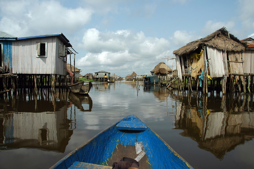
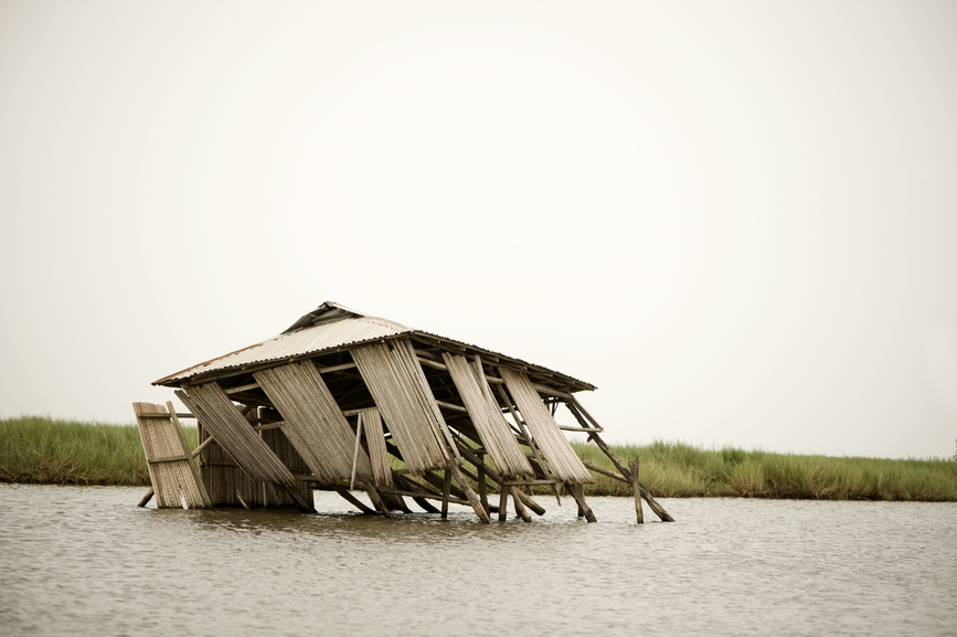
The town of Ganvier is called the Venice of Africa. It is a village built over Lake Nokue. Piles are driven into the bottom of the lake, on which bamboo huts are supported. The distance between them and the surface of the water is about two meters. Also on the pilings are structures with a local hotel, restaurants, stores, and schools. The need for such a settlement on stilts arose in ancient times for protection from warriors whose religion did not allow entering the water.
Of interest to tourists is the town of Ouida. This place was called in the old days the point of no return. It was the terminus on the continent for Africans being sent into slavery. In the historical museum of the city there is an exposition about the slave trade. There is also a Temple of Snakes with sleeping peonies.
What the people of Benin eat
The cuisine of Benin can not be called diverse. The inhabitants of the state mainly eat rice, corn, macaroni, soft cheese. Spicy seasonings and sauces are popular. The national dish is called fufu. It is a porridge made of yam. Locals also eat dishes from various insects (locusts, dragonflies, ants). Drinks are not distinguished by originality either. They are coffee, most often instant, banana tea, pineapple lemonade, juices diluted with water. Alcoholic drinks are represented by palm wine, local moonshine, rum. Food is supplemented with all kinds of fruits, available here in abundance. It is noteworthy that Benin is an agrarian country, able to provide its population with basic foodstuffs.
Transportation
The most convenient way to travel around the country is by bus. Bus services cover the main cities and villages. Asphalted roads connect the south and the north. The buses themselves are of decent quality. Another type of public transportation are bush cabs. Their advantage can be called the service of the most remote areas. Also, to get on a bush cab, you do not have to look for a bus stop. The fare is higher than a bus, but it is not fixed, you can bargain. It is usually packed with a lot of people. Another form of transportation is called zemidjan. It is a motorcycle cab, probably the cheapest and most convenient way to get to the desired point.
Video Benin

