PJ7K Team will be active from Sint Maarten, IOTA NA - 105, 12 - 22 September 2025.
Team - OK1FCJ, OK2ZA, OK2ZC, OK6DJ, OM5ZW.
Recent DX Spots PJ7K
PJ7K Log search They will operate on 160 - 6m and satellites, CW, SSB, Digital modes.
QSL via OK6DJ.
PJ7K call sign used before.
Previous activity:
Toshi JA1ELY, Yuki JH1NBN, Hal JR4OZR will be active from Sint Maarten Island (IOTA NA-105) 19 - 25 November 2015 as PJ7ELY and PJ7K.
They will operate on 80 - 10m CW, SSB, RTTY.
QSL via JA1ELY, OQRS.
Ads for direct QSL:
TOSHIKAZU KUSANO, JA1ELY, P.O.BOX 8, KAMATA, TOKYO, 144-8691, Japan.
Sint Maarten – a distant “Dutchman” in the Caribbean Sea
A self-governing territory with broad powers, Sint Maarten is part of the Netherlands and has the status of a state entity within that kingdom. It is located in the south of the island of Saint Martin and shares a border more than 10 km long with the French territory in the northern part of the island. Sint Maarten is characterized by a hilly terrain and a rugged coastline, and its area is 34 km2. The island on which this state entity is located is washed by the waters of the Caribbean Sea in the southwest, and its northeastern shores face the Atlantic Ocean. Puerto Rico lies 300 km to the west, and Venezuela is located 910 km to the south. Sint Maarten has air links with the neighboring island of Anguilla, located 15 km to the north.

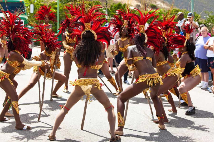
Sint Maarten. Carnival. Author - Christophe Seger.
Arawak salt mines
Before European sailors arrived on the island, it was ruled by numerous Arawak tribes who had migrated here from the shores of South America and found rich salt deposits on the island. In 1493, during his expedition to the New World, Columbus discovered these lands and mapped the coastline of several nearby volcanic formations: Chicken, Little Key, and Hen. However, the island itself was not settled by the Spanish, and a century and a half later, in 1631, the Dutch arrived on its shores and appreciated the rich salt deposits. Soon, French colonists began to settle the island, clashing with the Dutch.
Spain, determined to regain control of these lands, sent a small expeditionary force there in 1633. This forced the French and Dutch to form a coalition and repel the Spanish invasion. In 1648, the island was divided between the two European states. The treaty that sealed this arrangement is still in force today. The southern part of the island went to the Netherlands, and today Sint Maarten is part of the kingdom, while retaining the right to elect a local council and form its own government.

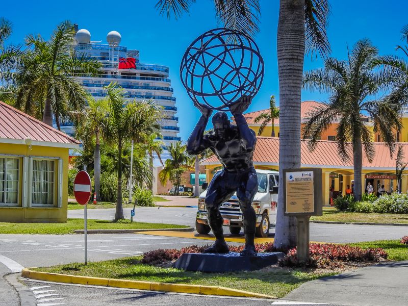
Sint Maarten. Author - Alan Leu.
Lagoons, beaches, and emerald hills
In the south of the island, sand deposits have formed spits—narrow strips of land that separate inland water bodies from the Caribbean Sea. Simpson Bay Lagoon in the west of Sint Maarten is considered the largest of these.
The entire coastline is dotted with small bays, and there are narrow straits between Saint Martin and the nearby islands. Dozens of beaches stretch from the sandy shoals in the west to Great Bay in the south.
The southern, gently sloping shores give way to the north to salt flats, which cover over 20% of Sint Maarten's territory. North of Great Salt Pond, low hills rise, stretching from the south to the border with the French part of the island. There was once significant volcanic activity here, as the entire area lies in a seismically active zone, but today only an extinct volcano, Flagstaff Mountain, about 386 m high, remains as a reminder of this.
The hills of Sint Maarten are covered with hibiscus, broad-leaved palms, and small tropical forests typical of the central regions. Cacti also grow here in large groups.
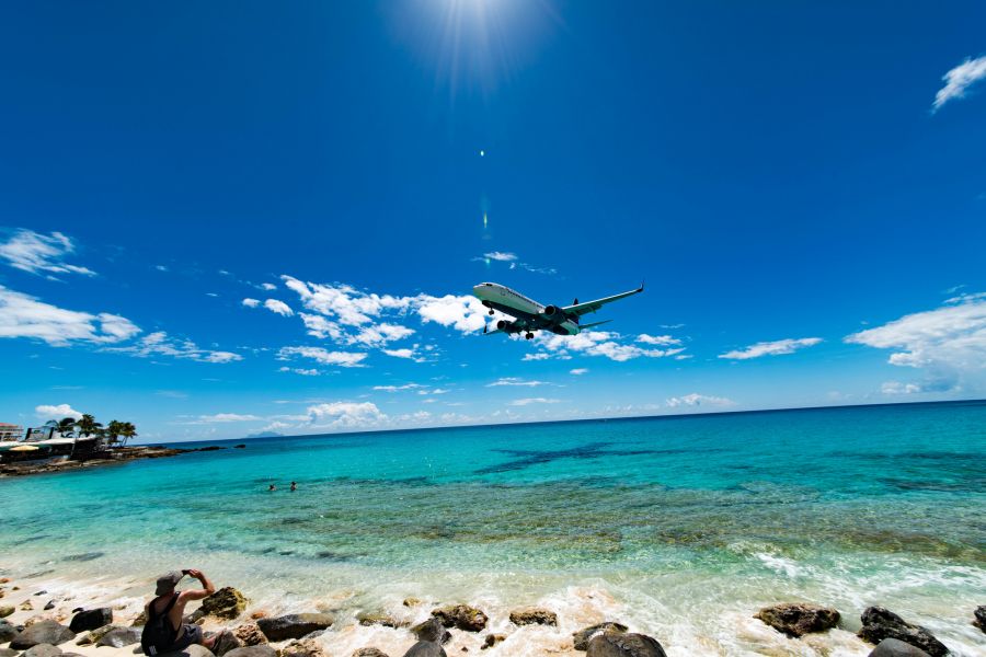
 Sint Maarten Island. Author - Masahiro Takagi.
Where it's summer all year round
“Little Holland” in the Caribbean Sea lies in the tropics, where the climate is predominantly maritime and trade winds blow. There are no seasonal changes on Sint Maarten, and the average temperature throughout the year is +26 °C. Even in winter (December-February), the thermometer rarely drops below +20-21 °C. The absence of temperature fluctuations makes the island comfortable to visit at any time of year.
In May, trade winds blow from the Atlantic, bringing moisture and blowing in a southwesterly direction. Most of the rain falls in the hilly central and northern areas of Sint Maarten (up to 900 mm), while in the west, precipitation decreases to 250-300 mm. The entire island lies on the edge of the hurricane belt in the Caribbean, and in late summer and early fall, hurricanes often hit these shores, bringing “diversity” to the measured life of the islanders.
A city of two streets
The population of Sint Maarten is about 37,000 people who speak Creole, English, Spanish, and Dutch. The latter has official status. In fact, the only city in the Dutch part of the island, Philipsburg, is its economic center. It is formed by the intersection of two main streets lined with elegant colonial-style houses.
The economy of Sint Maarten is based on tourism. Vacationers arrive at the airport in the southwest of the island. An interesting fact: as they come in to land, planes fly over the heads of those basking on Maho Beach. It's a spectacular sight and an unforgettable experience!
Sint Maarten – the spirit of Holland in the Caribbean!

