T33TTT Team will be active from Banaba Island, IOTA OC - 018, during September 2025.
Team - Members of the Rebel DX Group.
Recent DX Spots T33TTT
T33TTT Log search They will operate on HF Bands, during 3 weeks.
QSL via ClubLog OQRS, LOTW.
DXCC Country - Banaba (Ocean) Island, T33.
Banaba Island
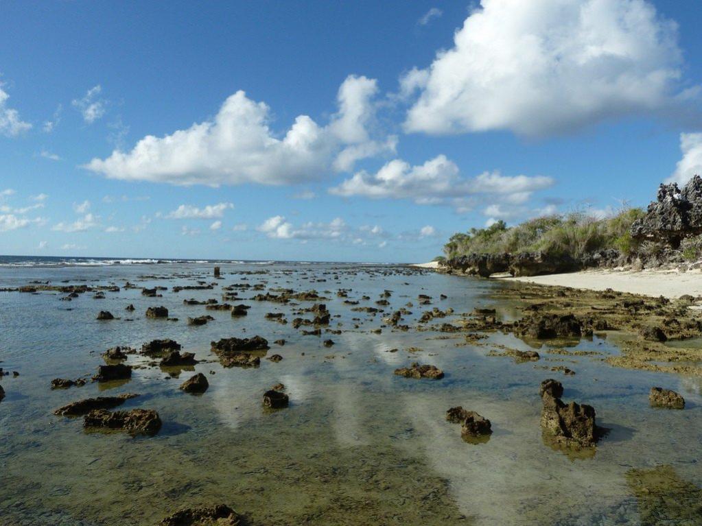
Sparsely populated and completely closed to the public, Banaba, with its perpetual scarcity of fresh water, has become a kind of hermit island that few people know about. And quite in vain! Despite the fact that it has suffered a lot in the process of active mining of minerals (phosphorites), something interesting has survived.
It is only necessary to obtain the consent of the Island Council to visit it, and the wide-open eyes of the tourist will see a lot of unique discoveries. Original dances, traditions, the beauty of some “surviving” pieces of land, untouched by man, blooming in tropical conditions... In general, there is definitely something to see here.
“Let me introduce myself!” - something about the name and language of Banaba
“Banaba” is a word from the lexicon of one of the largest Micronesian languages - Gilbertian, or Kiribati - spoken by nearly one hundred thousand people worldwide, the vast majority of whom live in the eponymous republic of Kiribati. The second name of the original language - Gilbertian - occurred when English colonists distorted the original pronunciation of one of the coral atolls, now called Gilbert Island.
English speakers were true to themselves, and in the same way, already in our time, distorted the original Kiribati name of another island, naming it “after” the first colonized the island tribe of natives who spoke “batabat”. Banaba also has a second, official name - Oshen. In English (Ocean) Oshen means “ocean” - such an association arose among Europeans due to the exceptional isolation of the island.

“Small is small”... a little bit about geography and size
A piece of land with a total area of 6.39 square kilometers (length - 3.2 km) is lost in the Pacific Ocean south of the Equator (0°51′30″ S 169°31′57″ E). If the Gilbert Archipelago is taken as a point of reference, then Oshen is located to the west of it. Banabu is separated from the eastern part of Nauru by 306 km of ocean water, and from the southwest of Tarawa by 600 km.
Banabu is an atoll that rises out of the water, which is why there is no taller island in the entire Republic of Kiribati.
State and political calling card
Politically, the island is not independent, as it is part of the Pacific Ocean state of the Republic of Kiribati, with South Tarawa as its capital. In the representative body of the Republic, the Assembly, there are two regular representatives of Oshen interests.
Banaba, due to its peculiarities (lack of agriculture, ruined land, etc.) is in desperate need of financial assistance, and the Fijian government every month sponsors the poor island with twelve thousand dollars. At the same time, the islanders still cherish the hope of gaining full political independence. The reason for this “stubbornness” is obvious: the small population has no rights to dispose of its land.

Meet the islanders
Now, the population on Oshen is shipshape - only about three hundred people, with a population density of 46 people per square kilometer of land. Before 1995, the islanders numbered 500, but the severe drought of that period forced some of the islanders to relocate. Even earlier, before the three-year drought of 1873, the population was even higher, at 2,000.
The villages of the islanders huddle on scraps of soil preserved untouched by phosphate mining. Legends say that the ancestors of the Banabans were “cruel men”, magicians and warriors from Vanuatu and travelers from Southeast Asia, but scientific theories tell a different story: the first to settle on the island were black Batabata.
The small number of the islanders keep their traditions sacred and communicate well with relatives who once (1945) moved to the more environmentally friendly island of Fiji.
Oshen values
Apart from the educational experience of experiencing Aboriginal culture, Banaba is attractive from a purely scientific point of view. Ecologists from all over the world come here, authorized by the Island Council, to study the tragic consequences of the mining industry. The land here was ruthlessly exploited until 1979, when the phosphate mined in huge quantities was processed into high-quality mineral fertilizers.
A few pages of history
For a very long time nothing was known about Banaba in Europe, so there are no accurate facts about the island until the first missionary settlement in 1868. In memory of the first islanders on Banaba remained pyramid-shrines made of stone: if you look in the slits of one of them, you can see a pair of ancient human skulls.
In 1979, the island went “under the hammer” at a throwaway price: the buyers were Australia and New Zealand. The new owners of Banaba began to restore almost completely eradicated agriculture here, cultivating 0.6 km. of surviving fertile land. Compared to the original 6 kilometers of farmland, the tenfold reduction has been extremely detrimental to the island's viability.

